


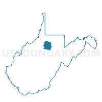
Johnstown Community Center Voting District, Harrison County, West Virginia
About
Outline

Summary
| Unique Area Identifier | 690799 |
| Name | Johnstown Community Center Voting District |
| County | Harrison County |
| State | West Virginia |
| Area (square miles) | 20.38 |
| Land Area (square miles) | 20.38 |
| Water Area (square miles) | 0.00 |
| % of Land Area | 100.00 |
| % of Water Area | 0.00 |
| Latitude of the Internal Point | 39.13077280 |
| Longtitude of the Internal Point | -80.27703860 |
Maps


Graphs
Select a template below for downloading or customizing gragh for Johnstown Community Center Voting District, Harrison County, West Virginia


Neighbors
Neighoring Voting District (by Name) Neighboring Voting District on the Map
- Voting District 13, Lewis County, WV
- Voting District 18, Barbour County, WV
- Voting District 19, Barbour County, WV
- Voting District 38, Upshur County, WV
- Grace Chapel Voting District, Harrison County, WV
- Lot Creek Community Building Voting District, Harrison County, WV
Top 10 Neighboring County Subdivision (by Population) Neighboring County Subdivision on the Map
- Southern district, Harrison County, WV (12,803)
- Second district, Upshur County, WV (8,296)
- Hackers Creek-Skin Creek district, Lewis County, WV (5,537)
- West district, Barbour County, WV (3,853)
Top 10 Neighboring Unified School District (by Population) Neighboring Unified School District on the Map
- Harrison County School District, WV (69,099)
- Upshur County School District, WV (24,254)
- Barbour County School District, WV (16,589)
- Lewis County School District, WV (16,372)
Top 10 Neighboring State Legislative District Lower Chamber (by Population) Neighboring State Legislative District Lower Chamber on the Map
- State House District 41, WV (71,101)
- State House District 40, WV (20,319)
- State House District 38, WV (17,592)
Top 10 Neighboring State Legislative District Upper Chamber (by Population) Neighboring State Legislative District Upper Chamber on the Map
- State Senate District 14, WV (121,969)
- State Senate District 11, WV (108,768)
- State Senate District 12, WV (108,687)
Top 10 Neighboring 111th Congressional District (by Population) Neighboring 111th Congressional District on the Map
Top 10 Neighboring Census Tract (by Population) Neighboring Census Tract on the Map
- Census Tract 9666, Upshur County, WV (4,368)
- Census Tract 9655, Barbour County, WV (3,979)
- Census Tract 9673, Lewis County, WV (3,534)
- Census Tract 313, Harrison County, WV (2,797)
- Census Tract 312, Harrison County, WV (2,148)
Top 10 Neighboring 5-Digit ZIP Code Tabulation Area (by Population) Neighboring 5-Digit ZIP Code Tabulation Area on the Map
- 26201, WV (19,701)
- 26416, WV (7,529)
- 26385, WV (3,872)
- 26378, WV (3,820)
- 26408, WV (2,852)
- 26238, WV (739)